Early Detection of Plant Stress
Preventing and minimizing the Cost of Cure of the Worlds' Plants

#1
Innovation
Unlike what is currently available in the market, farmAIr technology (patented) use thermal images and Artificial Intelligence, in order to reveal Plant Stress, before the onset of any symptom. We help farmers and agronomists to spot what they can't see with the naked eye, so as to be aware and take all necessary precautions and actions, that will help prevent any spread. At the moment, farmAIr technology is available for vineyards, planning to gradually expand to virtually any plant with leaves
Create AccountHow to use the service

Create your account
You need just one minute to register, so don’t waste time and step into the future, using our technology. Monitor the progress of your crops, and ultimately improve their overall health and efficiency.
Sign Up
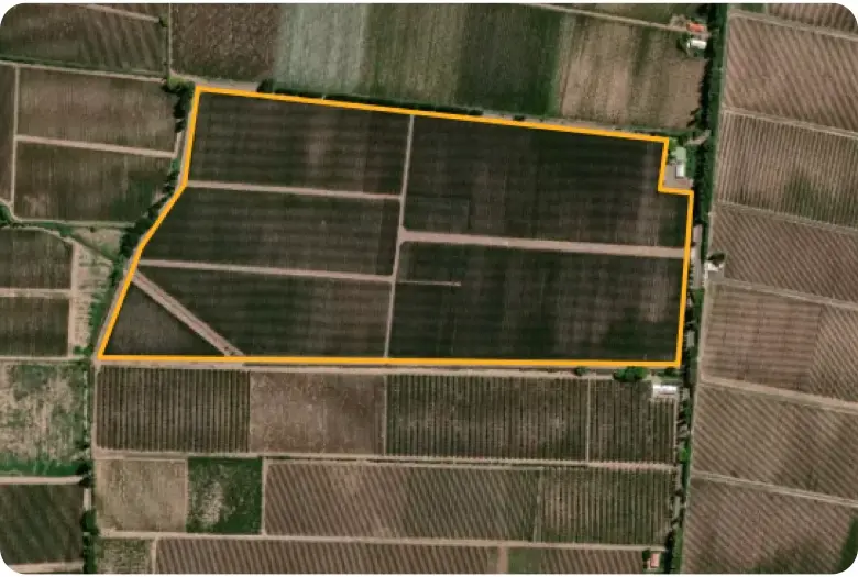
Add your Field
Select your field on the satellite map with our easy-to-use drawing tool and provide us with some additional information about your vineyard (more crops are coming soon).
Choose between our End to End or Bring Your Own Images packages.
You can either enjoy the full package, by booking the drone surveying of your field with us, or take over aerial photo shooting yourself, and upload your own images – just contact us beforehand in order to comply with our image spec requirements.

AI processing
Our sophisticated AI algorithms will process the images of your field. It is not magic, it is the new age, cutting edge technology that farmAIr is bringing to you now, saving you time, money and effort.

Check the Results
You can check the results from anywhere. You just need an internet connection. Login to your account and check your report to see if you have any stressed plants in your field. Go back to past reports anytime to identify any patterns. Is that simple!

Navigate to each stressed plant
You have stressed plants that you can’t see with your naked eye? No need to worry! Click on the pins on your field’s report, see the picture and simply walk to the stressed plant. The distance calculator will help you locate the exact position on the map.

Our Technology
Early detection of plant stress is a unique AgriTech break through innovation service that only farmAIr can provide.
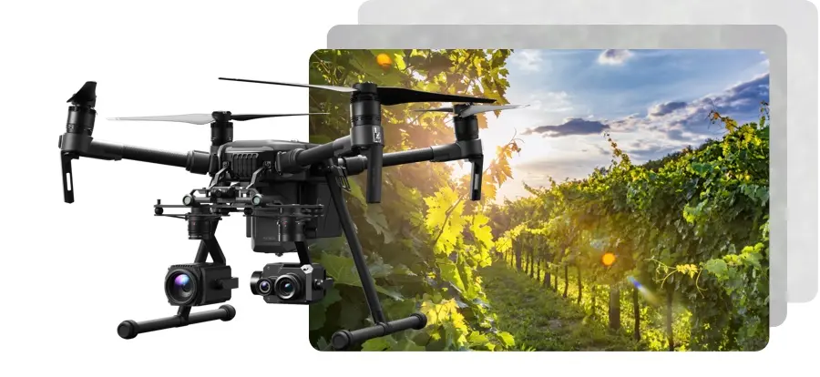
farmAIr technology combines thermal and visual images, machine learning and Artificial Intelligence, in order to reveal Plant Stress, before any symptom is expressed, helping for preemptive measures that will minimize costs. We employ drones, equipped with dual cameras for remote sensing and aerial photography scanning and diagnosis of your field.
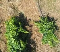
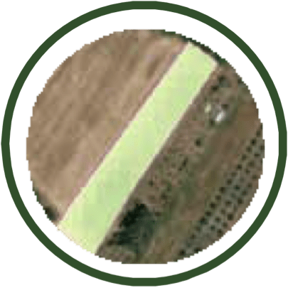
Visual Image
We utilize the full potential of high-resolution visual aerial photographs to isolate the plants from the soil.
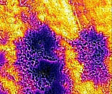
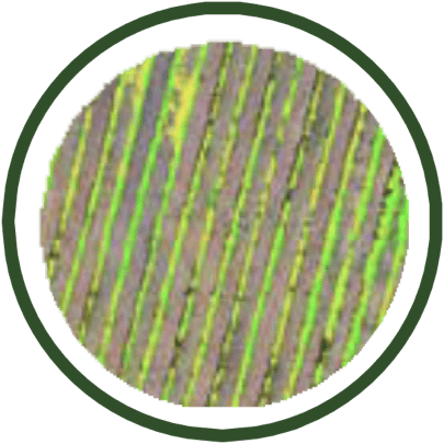
Thermal Image
We use thermal aerial photographs in order to understand from the leaves’ relative temperature if there is stress.
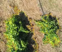
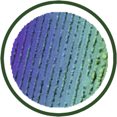
Image Fusion
Our machine learning algorithms combine visual and thermal images, creating a new set of images of pseudo-color-indicated sub-areas, for every plant having stress (if any).
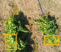
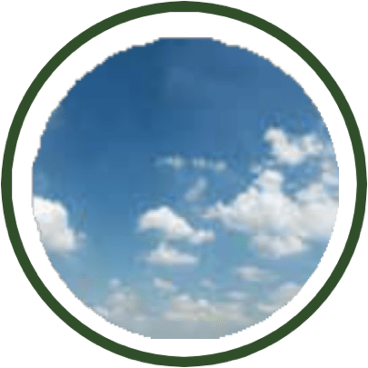
Artificial Intelligence identifies the problem
Our Object Detection algorithms automatically produce delimited sub-areas of the plant(s) having stress.
Our technology will make you see
Plant stress is not visible to the naked eye in the early stages, but as of today, you are able to know well in advance. Thanks to our pseudo-color image, you are able to clearly indicate the problem well in advance and act, giving you time to act proactively, and conserve considerable costs.
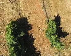
30 days later
The problem which our technology revealed 30 days before, is now evident on the infected plan, since no action had been taken in that case.
Our Platform
Gain access to your field data from your mobile, tablet and desktop. Our digital platform is a secure and easy to use software application designed to simplify crop scouting.
What we offer
farmAIr is a dynamic, flexible and customer-oriented AgriTech company, committed to always bring cutting-edge technology and the best experience to you.
Weather Data
Live, historical (up to 7 days before the shooting), and a 3-day forecast of temperature, wind speed, barometric pressure, moisture, precipitation, and cloud coverage – absolute values & graphs.
Early & Accurate detection of plant stress (Pat)
Biotic and Abiotic Plant stress detection, using high-definition thermal and digital cameras farmAIr’s Artificial Intelligence.
Soil Data
Moisture & temperature of the soil surface and the temperature at 10 cm below the soil surface, 2 times per day & historical data (at the shooting day) - absolute values & graphs.
Vegetation and Water content Indexes
Satellite images and graphs (daily and historical data at +/- 8 days from the shooting day) of the EVI (Enhanced Vegetation Index), NDVI (Normalized Difference Vegetation Index) & NDWI (Normalized Difference Water Index).
Low Chlorophyll Content
High-definition depiction of the low chlorophyll content areas of the field – The low chlorophyll content at non-stressed plants is a possible indication of nitrogen fertilization need.
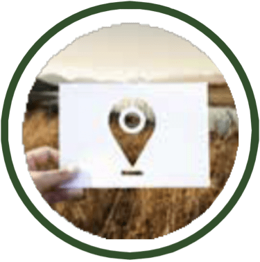
Navigate to the problematic plant(s)
Navigate using your cell phone or tablet in those areas requiring your attention - High accuracy georeferenced images (GPS), navigation deviation of less than 10 cm.
Digital Surface Map
High-definition depiction of the height difference within the field and of each individual vine trunk – as an indication of potential irrigation or drainage issues.
Comprehensive Stress Detection Report
Download your all-inclusive summary pdf report after the photoshoot of your filed, see all the findings, key data & forecasts in one place and share it with your scientific team.
In cooperation with:
Our strong and valuable partners and supporters


Read our blog
Read our latest news and our actions in Agriculture Technology Ecosystem.


